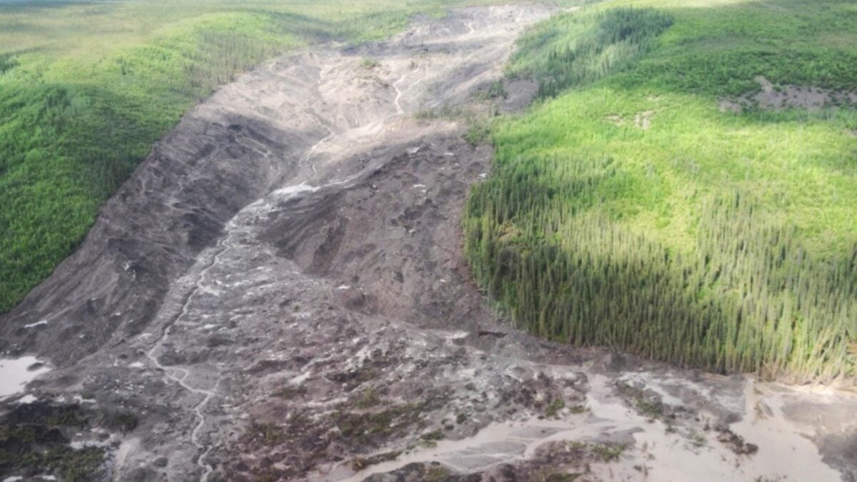
Two massive landslides that struck river valleys in Canada's Northwest Territories in 2017 and 2018 belong to a previously unrecognized category of slope failure, according to a study published in Geophysical Research Letters. The researchers, led by Joseph Young during his doctoral work at the University of Alberta, call the events "permafrost detachment slides," Gizmodo reports. Their analysis points to rising temperatures and severe wildfires as the forces that set the stage for the collapses.
The 2017 slide tore through the Johnson River Valley, sending house-sized blocks of frozen ground downhill and cutting a scar roughly 2 miles (3 kilometers) long into the terrain. Nothing on that scale had been recorded in the region before. A year later, a second slide hit the Redstone River Valley. It was smaller but still enormous, shifting about 160 million cubic feet (4.5 million cubic meters) of material — around a quarter of what the 2017 event moved. In both cases, large slabs of permafrost broke loose and traveled downslope as solid masses, a pattern that differs sharply from the muddy flow typical of thawing ground.
Why it matters
Permafrost underlies vast stretches of northern Canada and Alaska, and how it fails as it warms has consequences for the landscape, waterways, and eventually the people and infrastructure nearby. The study describes a mechanism that releases frozen ground in sudden, cohesive blocks rather than a gradual surface ooze — a style of collapse that can move far more material at once. According to Gizmodo, the researchers have already catalogued hundreds of comparable slides across the Mackenzie Valley, in areas where the frozen layer is thinner than 131 feet (40 meters) and warmer than 30.2 degrees Fahrenheit (minus 1 degree Celsius). The two largest events have not damaged infrastructure in this sparsely populated region, but they did block rivers and form new lakes. As temperatures climb and wildfires grow more severe, the team expects this kind of landslide to appear more often in Canada and Alaska.
How the ground came apart
The two slides occurred in the discontinuous permafrost zone of the central Mackenzie Valley, where the frozen layer is generally 66 to 131 feet (20 to 40 meters) thick and sits close to its melting point. Between 1980 and 2020, permafrost in the area warmed by about 0.5 degrees F (0.3 degrees C) each decade. In 1995, severe wildfires burned across the same areas where both slides later occurred.
Young and his colleagues combined satellite imagery, drone surveys, field samples, geophysical measurements, and computer modeling to reconstruct what happened. Their reconstruction suggests that warmer surface conditions and the intense heat of fires triggered small movements in the frozen ground, opening cracks. Water then seeped down through those cracks and melted the permafrost from underneath — a bottom-up process that is unusual, since thaw normally proceeds from the surface downward and produces the soupy ground familiar in many northern landscapes.
Once the base of the frozen layer gives way, the whole slab can lose its footing and slide downhill quickly as a single block. That is what the researchers believe occurred in both valleys. The timing also fits their model: water moving through cracks in the upper ground can take about 20 years to reach the base of the permafrost, which places the slides roughly two decades after the 1995 fires.
A hazard tied to fire and heat
The study ties the new slide type to two climate-related trends acting together: gradual warming of the frozen ground and the growing size, heat, and duration of wildfires. Gizmodo reports that the authors expect these conditions to make permafrost detachment slides more frequent across Canada and Alaska. The hundreds of similar features the team identified in the Mackenzie Valley suggest the mechanism is not confined to the two well-documented events.
The region's remoteness has limited the immediate toll. No infrastructure has been harmed so far, though the river blockages and the lakes they created show that the slides can reshape drainage in a hurry. Each future event, the researchers note, will give scientists another chance to study a hazard that is still poorly understood and to track how it is altering a fast-changing part of the North.
Watch for follow-up surveys of the hundreds of candidate sites the team mapped, and for whether similar detachment slides are confirmed in Alaska as fire seasons intensify.